Decision Support System with UAVs for high-altitude environments
Source of Funding: National Program of Agrarian Innovation (PNIA).
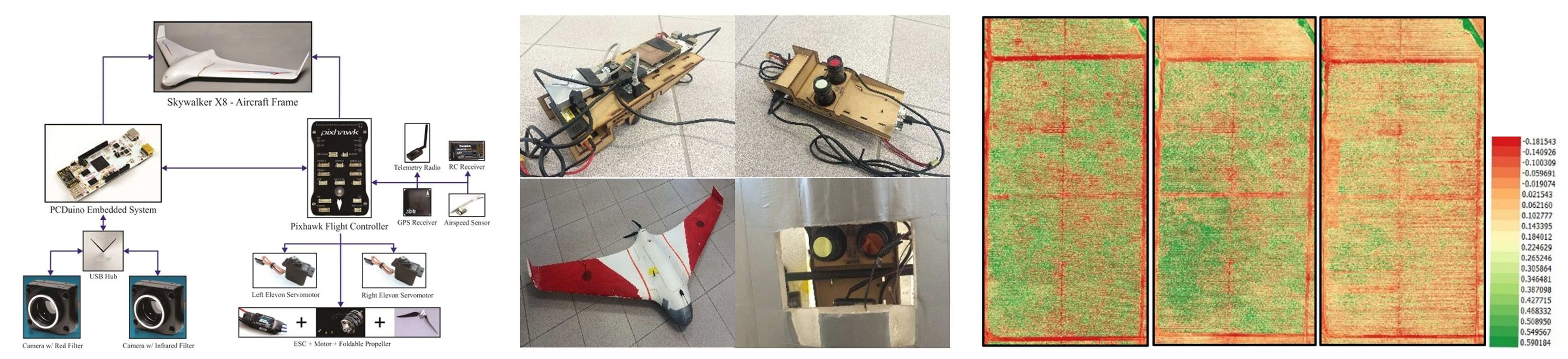
The aim of the project is the development of a decision support system based on multispectral aerial imaging obtained through UAVs to help farmers in high-altitude environments in High Andean locations determine soil fertility, irrigation efficiency and estimate crop yield, among other benefits to reduce the impact of climate change.
The main tasks performed in this project were the following:
- Development of a low-cost image acquisition system consisting of an embedded board and two multispectral cameras.
- Design and fabrication of a prototype structure to attach image acquisition system to UAV systems.
- Acquisition system evaluation in flight missions carried out over high-altitude crops.
Papers
- Study of effects of high-altitude environments on multicopter and fixed-wing UAVs’ energy consumption and flight time (More details)
- Multispectral imaging system with UAV integration capabilities for crop analysis (More details)
- Multispectral imaging of crops in the Peruvian Highlands through a fixed-wing UAV system (More details)
- Aerial photography for 3D reconstruction in the Peruvian Highlands through a fixed-wing UAV system (More details)
Video
- Dron del IGP y PUCP sobrevuela cráter del volcán Ubinas [IGP and PUCP drone overflies the crater of the Ubinas volcano] (Link)